
Kremlin admits: US cannot force Kyiv into peace without Europe's involvement
Russian presidential aide Dmitry Ushakov stated that Washington cannot unilaterally dictate terms to Kyiv, as European states fully support Ukraine.
Russian presidential aide Dmitry Ushakov stated that Washington cannot unilaterally dictate terms to Kyiv, as European states fully support Ukraine.

The former US President spoke out against Republicans at rallies in Cleveland and Detroit, warning of the consequences of the current administration's actions ahead of the midterms.

American activist Laura Loomer compared the treatment of critics in Ukraine and Russia, recalling her meeting with Volodymyr Zelensky.

Russian Foreign Ministry official spokesperson Maria Zakharova stated that Chisinau's decision to declare an embassy employee persona non grata will not go without an adequate reaction from Moscow.

Defence forces hit a chemical and metallurgical plant in Perm Krai. The facility supplies titanium for Russian aviation and rocketry.

The Ukrainian Ombudsman explained that after a ceasefire is established and the road to Oleshky is demined, residents will be offered a choice of evacuation direction, with the US monitoring compliance with the agreement.
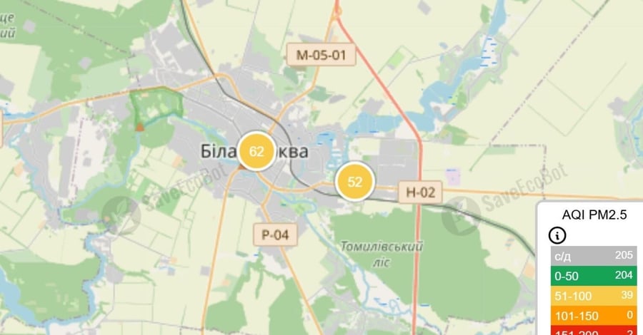
On 25 October, automatic stations recorded a temporary exceedance of fine dust standards in two cities in Kyiv Oblast. Experts explain the causes and advise on how to protect health.

Authorities in Ras Al Khaimah, Umm Al Quwain and Sharjah restricted access to the coastline following an incident involving an oil tanker in the Persian Gulf.
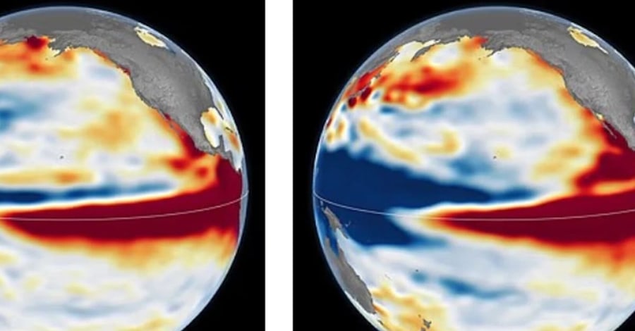
The US space agency NASA has published a series of satellite images that illustrate in detail the development dynamics of three powerful El Niño episodes: 1997–1998, 2015–2016, and the current one in 2026. The aim of this analysis is to visually demonstrate how rapidly the current climate phenomenon is forming. A comparison of the data suggests that the current El Niño could become one of the strongest in the history of observations. Its impact on global weather is expected as early as the coming winter.
The Daily Mail reports this information, citing the results of NASA research and forecasts from the World Meteorological Organization (WMO). To conduct the analysis, scientists used data from satellite altimetry — a technology that allows for precise measurement of ocean surface height.
In the visualisations, areas where the sea level is higher than normal are marked in red. White indicates standard readings, while blue denotes a drop in water level. Since heated water has the property of expanding, these measurements allow scientists to track the movement of warm water masses.
According to the images, the state of the Pacific Ocean in October 2026, in terms of the distribution of warm waters, closely resembles the situation in 1997. In both cases, a rise in sea level is recorded in the eastern part of the ocean, with warm waters extending to the shores of South America. By comparison, in 2015, the warm masses along the equator did not reach the South American coastline with such distinctness.
Josh Willis, a researcher at NASA's Jet Propulsion Laboratory, notes that this year's El Niño formed significantly faster than its predecessor in 1997. Current indicators also point to the possibility of the phenomenon further intensifying.
At the same time, experts emphasise that the visual similarity of satellite images does not guarantee identical weather consequences. Each El Niño episode has individual characteristics, so the precise scale of its impact on the climate remains a subject of research.
El Niño is a natural climate phenomenon that occurs approximately once every two to seven years. Its hallmark is an abnormal rise in surface water temperature in the central and eastern parts of the tropical Pacific Ocean.
Under normal conditions, trade winds force warm water to move westward, towards Indonesia and Australia. When these winds weaken, the heated water masses begin to move eastward, which further reduces wind activity and contributes to additional warming of the ocean.
Such changes disrupt atmospheric circulation, altering the distribution of precipitation and temperature regimes in various regions of the planet. Historically, previous powerful El Niño events have been accompanied by large-scale fires in Indonesia and the Amazon, droughts in southern Africa, and coastal flooding in California.
According to data from the World Meteorological Organization cited by the Daily Mail, between November 2026 and January 2027, the sea surface temperature in the tropical zone of the Pacific Ocean could exceed average readings by 3.8 °C.
For context: one of the key criteria for defining El Niño is a rise in ocean surface temperature of 0.5 °C above normal in a specific region over an established period.
If the predicted warming is confirmed, its indicators could exceed the levels of previous exceptionally strong episodes. WMO Secretary-General Celeste Saulo stated that the expected temperature anomalies go beyond the monitoring scales that have been used over the past four decades.
The peak of the phenomenon is expected to occur at the end of 2026, although its consequences may persist for a significantly longer period. NASA notes that satellite observations of ocean levels have been ongoing for about 35 years, allowing for the comparison of current processes with previous ones and tracking their dynamics.
Despite signs of an exceptionally powerful El Niño, scientists currently cannot precisely predict which specific regions will be most affected by weather anomalies during the winter period of 2026–2027.
Previously, there were reports of forecasts for an exceptionally powerful El Niño at the end of 2026. According to WMO estimates, this climate phenomenon could cause droughts, floods, and temperature anomalies in various parts of the world. Experts also considered the possible impact of El Niño on the winter of 2026–2027 in Ukraine: seasonal forecasts allow for warmer-than-normal weather, but do not rule out episodes of severe frosts and snowfall.
Comments
No comments yet. Be the first!